Feature, Contour & Topographic Surveys
Just purchased a block of land? Want to design and build your dream home? Looking at rebuilding, developing, alterations or additions on your existing house/lot?
If you’re doing any of the above, you’ll need a feature contour survey of your entire lot.
Feature Contour Surveyors
This type of survey shows all level, trees, buildings and visible services (if applicable) including:
- neighbouring buildings within 1m from the boundary,
- location and detail of all underground services,
- position of utility connections,
- contour levels to Australian Height Datum,
- original boundaries and dimensions.
Plans for approval
Once you have your survey accurately performed by a Land Surveyors Perth professional, you can confidently submit your plans (or building plans) to local authorities in the required format for approval.
All survey plans are available in hard copy and can also be emailed to the preferred electronic format of your architect, builder or draughtsperson.
Topographic survey
A topographic survey is another name for a feature contour survey. Therefore, if you’ve been told you require a topographic survey (or topographic surveying and mapping) of your Perth property, the information provided here is appropriate. Land Surveyors Perth also specialise in boundary, subdivision and engineering surveys.
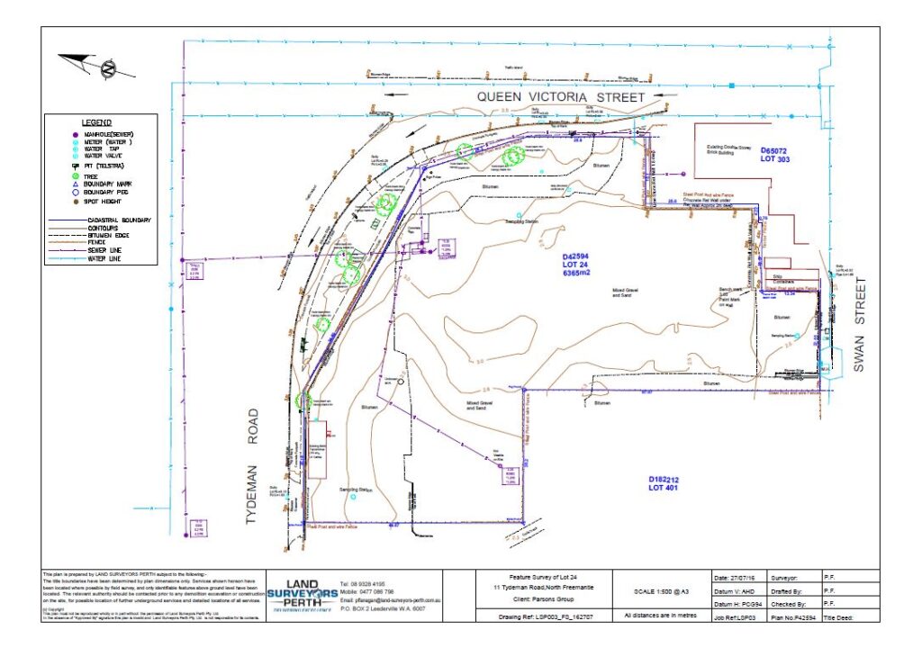
Example of a feature contour survey
Below is an example of a recent feature contour survey performed by a Land Surveyors Perth professional. All existing buildings, levels and block measurements are clearly articulated, providing your designer with all he/she needs to expedient your project and gain approval from your local authority.
Contact us for free advice or a quote
For more information, contact us today. We’re happy to give free advice – or a free quote on your project requirements. Fill out the contact form and a qualified professional will get back to you within 24 hours.
Get a Free Surveying Quote
We’ll get back to you within 24hrs
"*" indicates required fields
Surveyor News
-
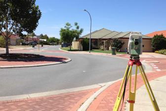
Surveyors can choose from a number of different instruments from a range of manufacturers in order to complete their basic work tasks. A standard set will typically complete all work on most sites to the highest degree of accuracy.
Leica equipment is the preferred manufacturer by many surveyors, as this equipment is widey regarded as the most accurate and reliable brand on the market.
At Land Surveyors Perth every survey crew sent to a site will contain a standard kit of tripods, pogo poles, hand tools and consumable items such as pegs, flagging tape, nails etc. Depending on the site conditions and accuracy required on site, the main equipment in a standard set will either be a Total Station (TS15) or a GPS. A digital level used for high accuracy levelling will commonly be included too.
Also depending on the project size and personnel required on site, there could be a number of both Total Stations and GPS on site.
When surveying is required to high accuracy, the Total Station is used and the most common model with Land Surveyors Perth is the Leica TS15. This will shoot accuracies of up to 0.5mm in ideal conditions. Whenever a Total Station in used on site, traverse kits are needed. A traverse kit consists of two tripod-mounted round prisms. The prisms are required initially with the Total Station to establish control points around the site.
Once the control points are in place, these prisms are then required for every set up of the total station in order to calculate the position where the total station is positioned. This is completed by a method or triangulation.
The GPS is used on sites which have accuracies of closer to 10mm in position and height. Control points for the GPS are usually set up in the same manner as described in the previous paragraph. Once control points are in place, the GPS can work on its own without the use of any other hardware.
An option to use with the GPS is a repeater. This will increase the range of how far the GPS rover can work from the GPS base. Depending on the OGS model used and the size and nature of the site, repeater units may or may not be required.
The Leica Sprinter 250M is a Digital Level capable of accuracies of 0.7mm. This accuracy will satisfy most high precision needs on any site. Used with this level is a barcode staff, which is how the digital level computes reduced levels to such accuracy.
Land Surveyors Perth are always equipped with the latest Leica equipment to ensure all surveying jobs are completed accurately and efficiently satisfying all clients.
No news for this service.
FAQS
Related Project
-
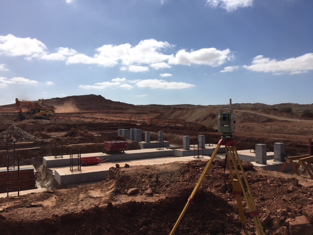
Clients: Whittens Group and RCR
Scope: Civil and SMP
Project Duration: 1 Year
Start Date: September 2017
Project Overview
Pilbara Minerals’ 100%-owned Pilgangoora Lithium-Tantalum Project, located 120km from Port Hedland in Western Australia’s resource-rich Pilbara region, is one of the biggest new lithium ore (spodumene) deposits in the world, with a globally significant hard rock spodumene resource.
Scope of Works-All SMP and Civil Surveying to include
- Underground services
- Reclaim tunnels
- Conveyor lines
- HPGR Vaults
- Spodumene storage slabs
- Ball mill
- Flotation Slabs
- Grinding slabs
- All associated steal structures
No project for this service.